i-Boating: Marine Charts & Gps 139.0.0
Free Version
Publisher Description
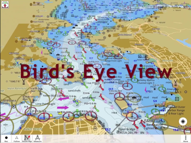


Marine Chartplotter for your iPhone/iPad. Detailed Marine Charts & Fishing Maps for US, Canada, Europe, and Australasia. Depth contour maps with Aids to Navigation.
This App offers access to Marine Charts for USA,Canada,UK/Ireland,Germany,Netherlands/Holland &
Europe Rivers (Danube,Drava,Rhein etc). Coverage includes NOAA marine vector
charts,freshwater lake maps,USACE inland river maps (HD/1ft/3ft bathymetry
included where available),charts derived from UKHO & CHS data. First marine GPS app to have route assistance with Voice Prompts for marine navigation. You can create new boating routes or import existing GPX/KML routes. It supports Nautical Charts course up orientation. Includes Tide & Currents prediction.
►FEATURES
√ Beautiful & detailed Hardware/GPU accelerated vector charts (text stays upright on rotation)
√ Long press to query the details of Marine object (Buoy,Lights,Obstruction etc).
√ Customizable depth(Ft/Fathom/Meter) & distance units(km/mi/NM)
√ Customizable Shallow Depth.
√ Record tracks,Autofollow with real-time track overlay & predicted path vector.
√ Voice Prompts for marine navigation (requires GPS )
√ 1ft / 3ft depth contour maps for anglers for selected lake maps.
√ Supports GPX/KML for boating route editing/import.
√ Tide & Currents prediction.
√ Seamless chart quilting of marine charts
√ Enter or import Waypoints.
► MAPS
It includes unlimited updates for 1 year.
√USA: The maps include coverage of all NOAA marine vector charts (ENC),USACE inland river maps,freshwater lake maps for more than 7K lakes. The charts include HD/1ft/3ft bathymetry where available.Incl. NOAA raster where ENC not available.
√Canada:Incl. CHS data(incl. major Lakes).
√UK/Ireland: Derived from UKHO charts.
√Australia
√Germany: derived from BSH data
√Europe Inland Rivers:Donau/Dunaja,Rhine,Garonne,Moselle,Drava,Sava,etc
√Norway
√Finland
√Sweden
√Croatia
√Ukraine(Black Sea)
√Caribbean
√New Zealand
√Spain
√Brazil
√Argentina
√Cyprus
√Falklands
√Seychelles& Mauritius
√Denmark
√Malta,Cyprus & S. Mediterranean
√S. China&Malaysia
√South Africa
►ROUTE MANAGEMENT / TRIP PLANNING
√ Create New Route/Edit Existing Routes
√ Move Points
√ Add points to an existing route leg
√ Delete / Rename points
√ Import GPX,KML & KMZ files
√ Plot/Edit Routes
√ Enter Waypoints
√ Share/Export Routes,Tracks&Markers
√ Reverse Routes
►SLIP TO SLIP AUTO ROUTING
►GPS FEATURES
√ Auto Follow
* Real Time Track Overlay
* Predicted Path Vector
* Course Up(Text stays upright)
* Speed & Heading
√ Route Assistance With Voice Prompts
* Prompts when approaching a boating route marker
* Continous distance & ETA updates
* Alerts when sailing/boating off route
* Alerts when boating in wrong direction
√ Record Tracks
►TIDE & CURRENTS
* For US,Canada,UK,Germany & New Zealand
* High/Low Tides
* Tidal Current Prediction
* Active Current Stations
►Instrumentation
√ Marine AIS & (NMEA AIS and GPS over TCP/UDP)
√ Wind direction & Speed,Marine Sonar depth,Water temperature
√ Auto Pilot
► SHARING
* Share tracks/routes/markers on Facebook & Twitter
* Export tracks/routes/markers as GPX files.
SUGARLOAF KEY-KEY WEST
PORT RICHEY TAMPA BAY - CLEARWATER HBR
EAST BAY-WEST BAY FLORIDA
INTRACOASTAL WATERWAY MATECUMBE-GRASSY KEY
CHESAPEAKE BAY CAPE CHARLES-NORFOLK HARBOR
ANCLOTE KEYS-CRYSTAL RIVER
ST JOSEPH SOUND
MIAMI HARBOR
Minnesota lakes - Kabetogama,Minnetonka,Waconia,Leech,Mille Lacs
Lake Keowee,Jocassee,Hartwell,Greenwood,Lake Murray
Mark Twain,Ozarks,Table Rock
Lake St.Clair
Lake Kentucky
KEY WEST-THE MISSISSIPPI RIVER
SAN PEDRO CHANNEL
LAKE MICHIGAN STONY LAKE-POINT BETSIE
APALACHICOLA BAY-CAPE SAN BLAS
EAST CAPE-MORMON KEY
CAPE HENLOPEN-INDIAN RIVER
CHESAPEAKE BAY CAPE HENRY-THIMBLE SHOAL
DULUTH-SUPERIOR
MONHEGAN ISLAND-CAPE ELIZABETH
ONTARIO - CLAYTON-FALSE DUCKS
Winnipesaukee
MIAMI-MARATHON,FLORIDA
CAPE MAY-FENWICK ISLAND
MISSISSIPPI RIVER-GALVESTON
CAPE CANAVERAL-KEY
DELAWARE RIVER WILMINGTON-PHILADELPHIA
FLORIDA KEYS SOMBRERO KEY-SAND KEY
SAN PABLO BAY
RAINY LAKE BIG ISLAND MINN-OAKPOINT
INTRACOASTAL WATERWAY-BISCAYNE BAY
EVERGLADES NTL PARK
HURON
TAHOE
CHESAPEAKE DELAWARE CANAL
BACKGROUND GPS CAN DECREASE BATTERY LIFE
Jan 17, 2024
Version 139.0.0
Major Update:
Lake Temperature Maps: Identify Fishing Hot Spots using Thermoclines accurate to 1°F (0.5° C).
About i-Boating: Marine Charts & Gps
i-Boating: Marine Charts & Gps is a free app for iOS published in the Recreation list of apps, part of Home & Hobby.
The company that develops i-Boating: Marine Charts & Gps is Bist LLC. The latest version released by its developer is 139.0.0.
To install i-Boating: Marine Charts & Gps on your iOS device, just click the green Continue To App button above to start the installation process. The app is listed on our website since 2024-01-17 and was downloaded 62 times. We have already checked if the download link is safe, however for your own protection we recommend that you scan the downloaded app with your antivirus. Your antivirus may detect the i-Boating: Marine Charts & Gps as malware if the download link is broken.
How to install i-Boating: Marine Charts & Gps on your iOS device:
- Click on the Continue To App button on our website. This will redirect you to the App Store.
- Once the i-Boating: Marine Charts & Gps is shown in the iTunes listing of your iOS device, you can start its download and installation. Tap on the GET button to the right of the app to start downloading it.
- If you are not logged-in the iOS appstore app, you'll be prompted for your your Apple ID and/or password.
- After i-Boating: Marine Charts & Gps is downloaded, you'll see an INSTALL button to the right. Tap on it to start the actual installation of the iOS app.
- Once installation is finished you can tap on the OPEN button to start it. Its icon will also be added to your device home screen.
